Анлайн версія аўдыягіда "Лідскі замак"
Карта Макоўскага (копія)
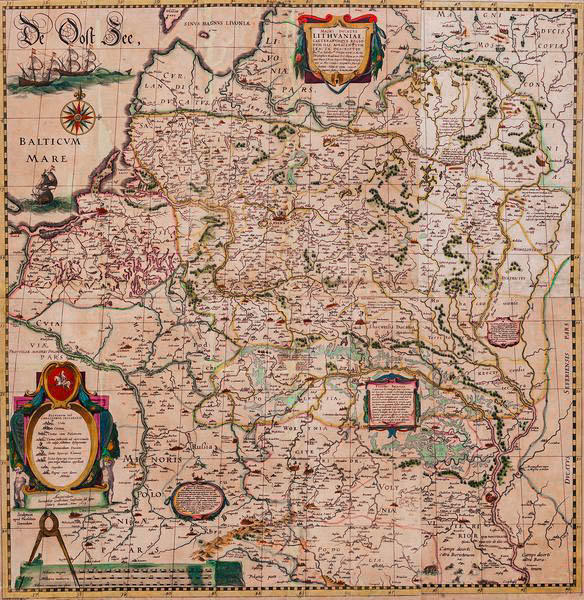
Карта Вялікага Княства Літоўскага 1613–1630 гадоў.
Ініцыятарам яе стварэння быў адзін з найбагацейшых магнатаў ВКЛ – Мікалай Крыштаф Радзівіл (Сіротка).
Праца па зборы матэрыялаў для стварэння карты вялася ў канцы XVI – пачатку XVII стагоддзяў у Нясвіжы. Малюнак і мастацкае афармленне карты зрабіў вядомы гравёр Тамаш Макоўскі.
Поўная версія карты складаецца з дзвюх частак: непасрэдна карты Вялікага Княства Літоўскага і карты ніжняга рэчышча Дняпра з парогамі. Усяго на карту нанесена 1039 населеных пунктаў, у тым ліку 544 у межах ВКЛ, з іх 342 – непасрэдна на тэрыторыі сучаснай Беларусі.
Усе надпісы былі зроблены на лацінскай мове. На карце прысутнічаюць гістарычныя звесткі і каментарыі пра населеныя пункты і іншая цікавая інфармацыя. Гэта першая буйнамаштабная карта Вялікага Княства Літоўскага.